🤔 What is Folium
Folium is a python library allowing to call the Leaflet.js Javascript library. It allows you to manipulate your data with python and map them using the power of leaflet! It is really easy to call a map using this library.
Folium can be installed with pip using the following:
pip install folium
👍 Most basic map
To create a map with Folium, simply pass the coordinates of the location you're interested in to the Map() function:
# Import the folium library
import folium

# Build the default map for a specific location
map = folium.Map(location=[43.61092, 3.87723])
mapWelcome to Montpellier, south of France, where I live most of the time 😊!
💾 Save as html
If you're not working in a jupyter notebook, you probably want to export the map to a standalone .html file. This is done thanks to the save function:
# Save the map to a specific location in my laptop
map.save('../../static/interactiveCharts/288_basic_folium_map.html')
You can now embed this page in any html document using an iframe. Open your .html document and add this somewhere:
%%html
<iframe
   src="/interactiveCharts/288_basic_folium_map.html"
   title="Basic map with folium"
   width="790"
   height="600"
>
</iframe>
🌈 Change tile
The folium library comes with several options for the background tile. The background tile is set thanks to the tiles parameter. For instance, let's visit Paris with a Cartodb Positron tile:
map = folium.Map(location=[48.85, 2.35],
                 tiles="Cartodb Positron", zoom_start=10)
map-
Cartodb dark matter
map = folium.Map(location=[48.85, 2.35],
                 tiles="Cartodb dark_matter", zoom_start=10)
map-
Open Street Map
map = folium.Map(
    location=[48.85, 2.35], tiles="OpenStreetMap", zoom_start=10)
mapNote: some mapbox tiles are available as well, but you need an API key for that
Going further
You might be interested in:
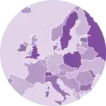
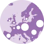
- building a bubble map with folium
- creating a choropleth map with folium
- learn more about maps in python